Understanding Drone Geofencing: A Comprehensive Guide
Introduction
The rapid advancement of drone technology has revolutionized various sectors, from agriculture to logistics, and even filmmaking. However, as drones become more prevalent in our skies, ensuring their safe and responsible use has become paramount. One of the key tools in this endeavor is geofencing, a technology that helps prevent drones from entering restricted areas. This article delves into the intricacies of drone geofencing, offering a comprehensive guide to understanding its mechanisms, applications, and implications.
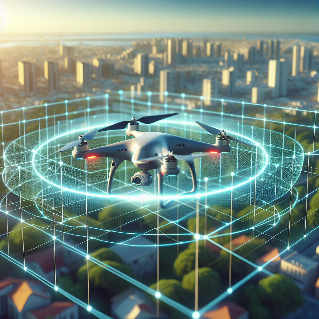
What is Drone Geofencing?
Geofencing is a technology that creates virtual boundaries around specific geographical areas using GPS or RFID technology. In the context of drones, geofencing restricts drones from flying into these predefined zones, which could include airports, military bases, or other sensitive locations. When a drone equipped with geofencing capabilities approaches one of these zones, it automatically alters its flight path or lands, ensuring compliance with the restricted airspace.
How Drone Geofencing Works
Integration of GPS Technology
At the core of geofencing technology is the Global Positioning System (GPS). Drones equipped with GPS receivers can determine their precise location, altitude, and speed. This data is crucial for geofencing, as it allows the drone to identify when it is approaching a restricted area based on preloaded geofencing data.
Predefined No-Fly Zones
Manufacturers or regulators define no-fly zones and integrate them into the drone’s software. These zones are typically based on national or regional aviation regulations. As a drone approaches a no-fly zone, the system cross-references its GPS data with the geofencing database to determine proximity to the restricted area.
Automated Drone Responses
Upon detection of a potential breach of a geofenced area, drones are programmed to take specific actions. These actions can include hovering in place, altering the flight path, or returning to the home point. The exact response depends on the drone’s programming and the severity of the intrusion risk.
Applications of Drone Geofencing
Enhancing Airspace Safety
One of the primary applications of drone geofencing is enhancing airspace safety. By preventing drones from entering restricted airspace, geofencing minimizes the risk of collisions with manned aircraft and protects sensitive areas from unauthorized drone activity. This is particularly crucial around airports, where even a minor incursion could lead to significant safety hazards.
Protecting Sensitive Areas
Geofencing is also instrumental in protecting sensitive areas such as government buildings, military installations, and critical infrastructure. By restricting drone access to these areas, geofencing helps prevent potential security breaches and ensures the privacy and safety of these locations.
Facilitating Compliance with Regulations
For drone operators, complying with aviation regulations is crucial to avoid legal repercussions. Geofencing assists in this by automating compliance, ensuring that drones do not inadvertently enter restricted airspace. This feature is especially beneficial for commercial operators who must adhere to strict operational guidelines.
Challenges and Limitations of Drone Geofencing
Accuracy and Reliability Issues
While geofencing technology is highly effective, it is not without its challenges. GPS signals can be subject to interference or inaccuracies, particularly in urban environments with tall buildings or in remote areas with limited satellite visibility. This can lead to geofencing errors, potentially resulting in unauthorized intrusions.
Dynamic and Temporary No-Fly Zones
Another limitation is the management of dynamic and temporary no-fly zones, such as those established for emergency response operations or public events. Keeping geofencing databases updated with these temporary restrictions can be challenging, requiring real-time data integration and regular updates.
User Overrides and Hacking Risks
Some drones allow operators to override geofencing restrictions, which poses a significant risk if used irresponsibly. Additionally, there is a potential for hacking or software manipulation, which could lead to unauthorized access to restricted areas despite geofencing measures.
Future of Drone Geofencing
Integration with UTM Systems
The future of drone geofencing is closely tied to the development of Unmanned Traffic Management (UTM) systems. These systems aim to integrate drones into the broader air traffic management framework, facilitating seamless coordination and communication between manned and unmanned aircraft. Geofencing will play a pivotal role in enabling this integration by ensuring drones operate safely within designated airspace.
Advancements in Geofencing Technology
As drone technology evolves, so too will geofencing capabilities. Advances in GPS accuracy, real-time data integration, and machine learning algorithms will enhance the precision and reliability of geofencing systems. These improvements will help address current limitations and expand the potential applications of geofencing.
Regulatory Developments
Regulatory bodies worldwide are continually updating drone regulations to keep pace with technological advancements. Future regulatory developments will likely include more comprehensive geofencing requirements, ensuring consistent and effective implementation across different regions and drone models.
Conclusion
Drone geofencing is an essential tool for ensuring the safe and responsible use of drones in our increasingly crowded skies. By preventing drones from entering restricted areas, geofencing helps protect airspace safety, secure sensitive locations, and facilitate compliance with aviation regulations. Despite its challenges and limitations, ongoing advancements in geofencing technology and regulatory frameworks promise a future where drones can operate safely and efficiently alongside manned aircraft. As drone technology continues to evolve, understanding and leveraging geofencing will be crucial for all stakeholders in the drone ecosystem, from manufacturers to operators and regulators.
#ChatGPT assisted in the creation of this article.
Share this content:

Post Comment